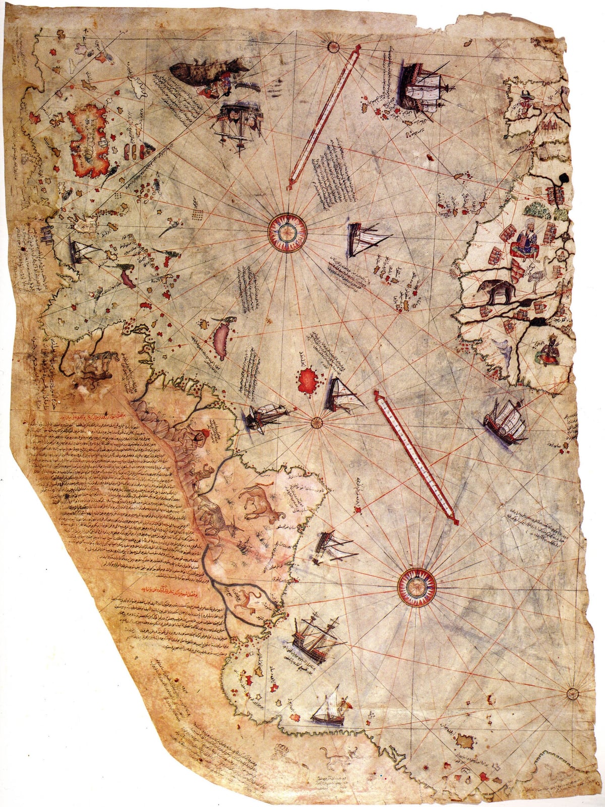
Piri Reis Draws a World Map with the New World on It
An Ottoman admiral compiled a map from many sources, including a lost Columbus chart.
In 1511, Ottoman naval commander and cartographer Piri Reis retired temporarily to the Aegean port of Gallipoli following the death of his uncle, the admiral Kemal Reis. There he began drafting a comprehensive world chart, completing the manuscript in the Islamic month of Muharram 919 AH, corresponding to early 1513. After participating in the Ottoman conquest of Egypt in 1517, Piri Reis presented the finished work to Sultan Selim I. Selim's practical use of the manuscript remains unrecorded, and the chart dropped out of administrative sight for centuries.
The document came to scholarly attention in 1929 during the conversion of Istanbul's Topkapı Palace into a public museum. While cataloging items from the library of Mehmed II with German theologian Gustav Adolf Deissmann, museum director Halil Edhem Eldem uncovered a bundle containing a painted gazelle-skin parchment. Orientalist Paul E. Kahle subsequently identified the sheet as the surviving western third of Piri Reis's 1513 world map. Measuring roughly 87 by 63 centimeters, the fragment depicts the Atlantic basin, showing the western coasts of Europe and Africa alongside eastern South America and the Caribbean.

Keep reading in Yester
Coming soon to the App Store
Keep following the story
Sources
Image: Piri Reis