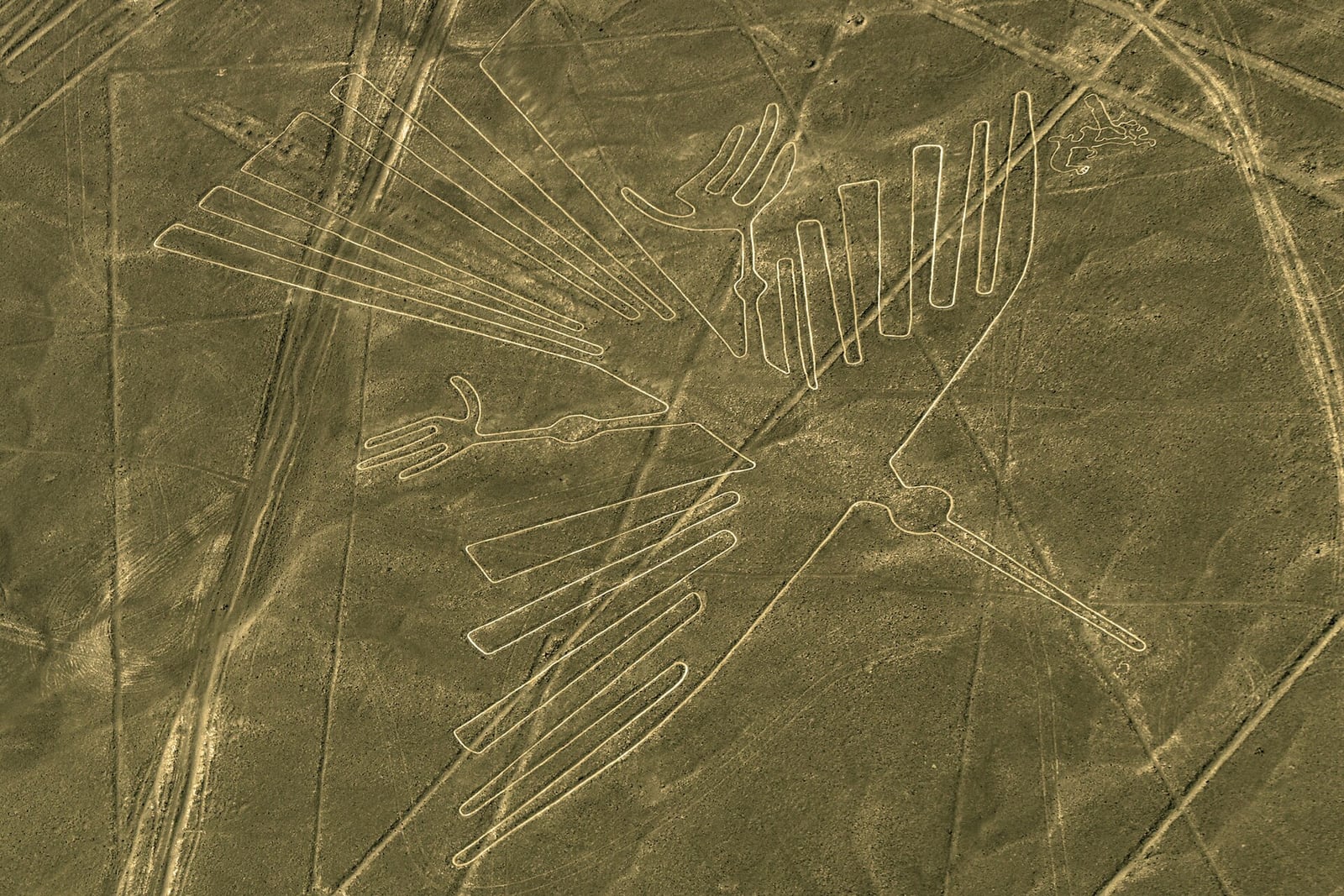
The Nazca Draw Giant Figures on the Desert
Lines and animal shapes stretch across the plain in southern Peru.
On the dry plateau between Nazca and Palpa in southern Peru, hundreds of expansive impressions cut across the arid landscape. Created primarily between 500 BC and 500 AD, these earthworks, known as geoglyphs, were produced by systematically clearing the top layer of dark, iron oxide-coated desert gravel to expose the lighter yellowish-grey clay beneath. The incisions are shallow, yet the stable, dry, and nearly windless climate of the region has preserved them for centuries.
The scope of this desert network is vast, encompassing simple straight courses, broad geometric shapes, and intricate outlines of plants and animals. Some lines measure only 30 centimeters wide, while others expand to nearly two meters. The longest individual animal figures reach lengths of roughly 370 meters. Among the zoomorphic outlines are depictions of a condor, a hummingbird, a monkey, a spider, and several fish and cats. Radiocarbon dating of wooden stakes discovered at the terminuses of several lines confirmed ancient dates for the construction, indicating that surveyors used basic tools and sighting markers to plot both linear axes and expansive curves directly onto the desert floor.

Keep reading in Yester
Coming soon to the App Store
Keep following the story
Sources
- Lines and Geoglyphs of Nasca and Palpa (UNESCO World Heritage Centre)
- Nazca lines in Peru (National Geographic)
- AI-accelerated Nazca survey nearly doubles the number of known figurative geoglyphs and sheds light on their purpose (Yamagata University)
- History of research (Association Dr. Maria Reiche, HTW Dresden)
- Nazca lines
Image: Roger Canals