Phosphate Mining Begins on Nauru
A tiny Pacific island lost much of its land surface to fertilizer mining.
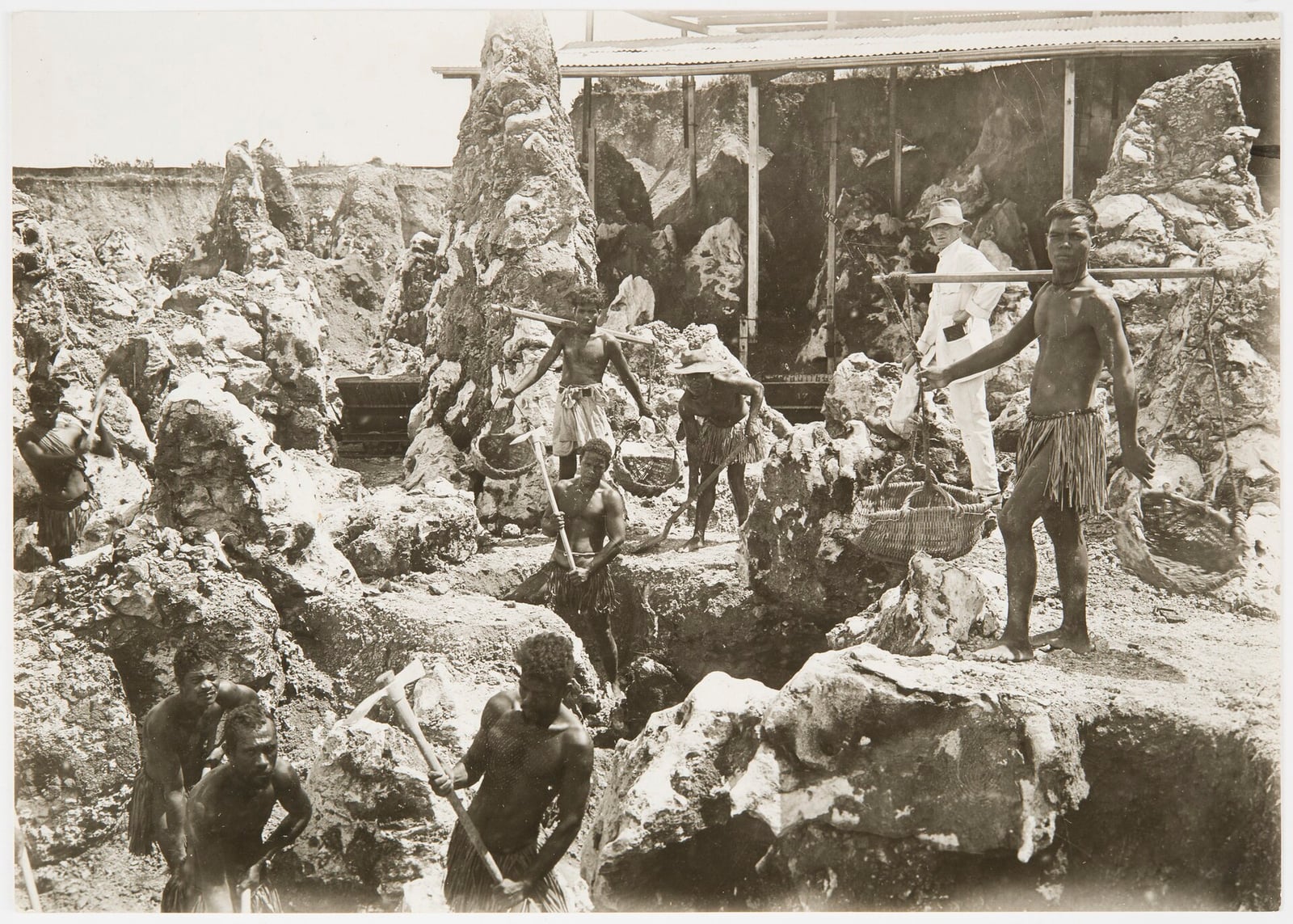
Rising from the central Pacific Ocean, the isolated island of Nauru sustained human habitation for thousands of years on a compact landmass of just twenty-one square kilometres. Early Nauruan society relied on the natural resources of a narrow fertile coastal belt and Buada Lagoon, where islanders raised juvenile milkfish alongside crops of coconut palms and pandanus. The central raised plateau, bounded by coral cliffs, formed the dominant landform of the interior, but its hidden geological wealth remained untouched until the turn of the twentieth century.
In 1900, the prospector Albert Fuller Ellis identified extensive phosphate rock deposits lying close to the surface across the central plateau. Germany had annexed Nauru in 1888, incorporating it into its Marshall Islands Protectorate. Seeking to commercialise the discovery, the Pacific Phosphate Company reached an agreement with the German authorities in 1906, and mining was under way by the following year, inaugurating an extractive industry that would permanently transform the local topography.

Keep reading in Yester
Coming soon to the App Store
Keep following the story
Sources
- Nauru: History (Encyclopaedia Britannica)
- Nauru (Encyclopaedia Britannica)
- Nauru: 50 Years of Independence (Library of Congress, In Custodia Legis)
- Nauru: Pleasant Island to the Pacific Solution (State Library of Queensland)
- Certain Phosphate Lands in Nauru (Nauru v. Australia) (International Court of Justice)
- Nauru
Image: Unknown author Unknown author